
In the spring, I had a dedicated volunteer come in twice weekly to number and index all our maps, of which we have nearly 300. These are not all original maps—some of them are copies of copies of copies, likely from a time when middle school students embarking on their Paideia projects came into the Farmington Room to do their research (nowadays the digitized versions of primary sources are used).
We are getting ready to digitize some of our maps, and some of those will be uploaded to the CT Digital Archive to be searched by YOU, wherever you are, at any hour of the day.
One important step of the process is to identify where these maps came from, mainly the ones that are clearly copies of some kind—photostatic, mimeograph, xerox, etc. Why? A few reasons:
1. The original map may be under copyright. If it’s not under copyright but is a government document, we may need permission to share the map. (There is fun research involved here.)
2. The original may be already digitized and easily accessible online (no need for duplicated efforts).
3. We may already have an original of the map elsewhere in the Farmington Room (I have found at least a few of those!).
Along the way, I chose to digitize some maps that we may not put up online for whatever reason and restrict their use because of copyright or other ownership issues. This is because digitization is not only about providing access; it is also about preservation.
We also may want to use an item in an exhibit, for strictly educational purposes, which is allowed with certain kinds of copyrighted materials. This is called “fair use” and is a great workaround for sharing—providing access to—the local history treasures living at your library.
Since exhibition of an original object can be harmful to some materials (light, humidity, fluctuating temperatures, and gravity are factors here), printing a digital surrogate of, say, a 1963 Farmington Street Map, will allow us to share the materials without harming the original. You may not think that a 60+ year old map would be all that old, but the more something is handled and moved around, the faster it will deteriorate over time, making it fragile and susceptible to damage.
While we’re on the topic of preservation, as archivists, we must balance providing access with prolonging the life of an object. Many folks love to look at or work with an original object, and there are certainly situations where that is warranted. However, if a digital surrogate can provide access to the content without handling the original, that allows us to provide more access to more people for a longer period of time. Lastly of course, having multiple copies (including digital) of our precious items are a safeguard against things like natural disasters, system failures, or other library emergencies.
Map Collection mysteries and finds
It has been quite the satisfying treasure hunt to identify some of these maps and track down their origins.
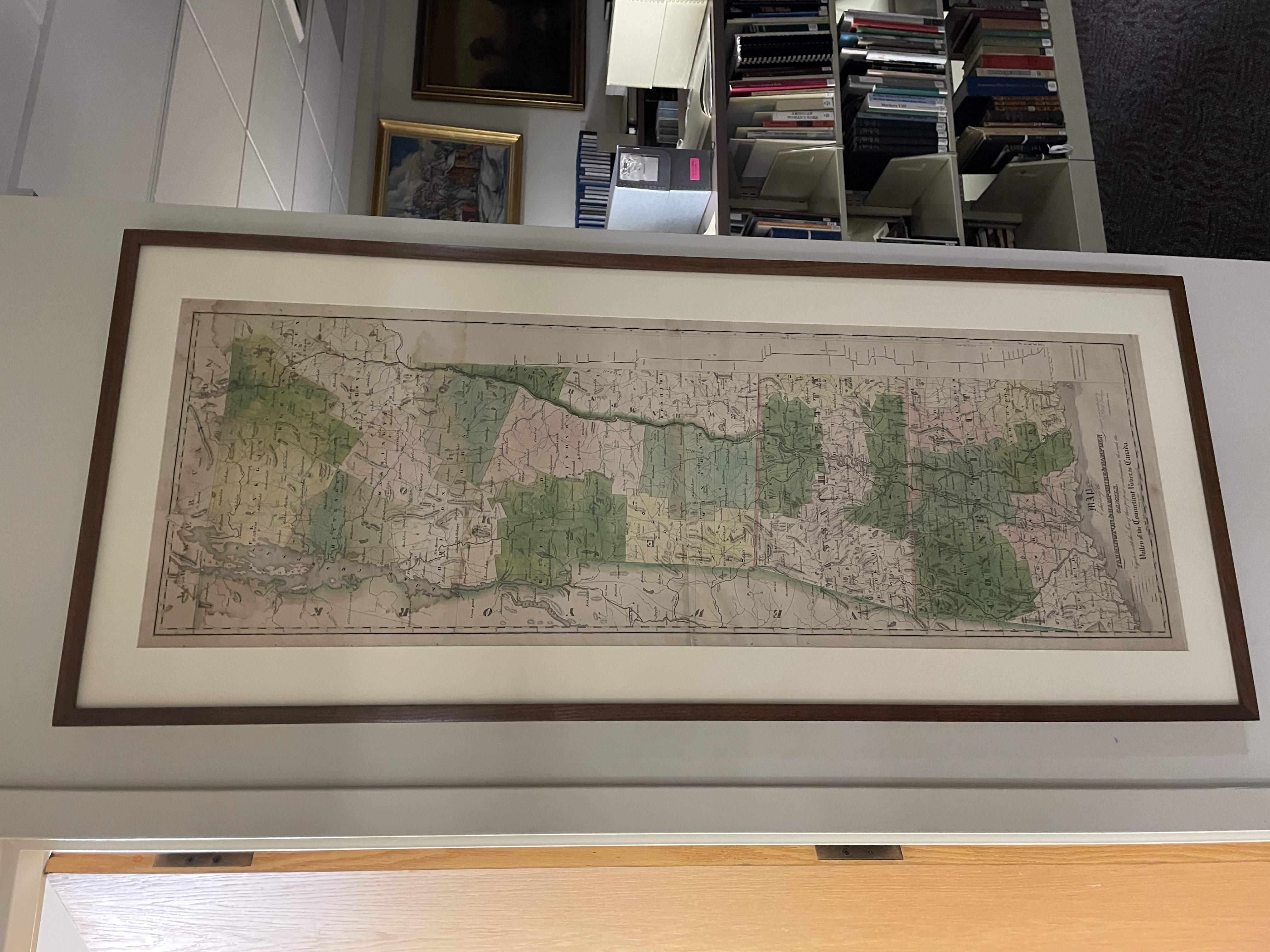
One map I found was of the northern half of Vermont. Since the Farmington Room’s collecting areas are focused on this town, its daughter towns, the Farmington Valley, and some county- and state-level materials…why do we have this map of Vermont?
I noticed that on the bottom right-hand side of the map showed where there were canal locks. So, I began searching for canal maps of Vermont. Nothing I found online matched, but it must have some connection to the Farmington Canal if we had it in our collection. I soon realized that it was one portion of the Farmington & Hampshire & Hampden Canal map. Then, I found the other half! The two halves are reunited and housed together in one of our map cases.
This map can be found online in the David Rumsey Map Collection (davidramsey.com), AND we happen to have a copy hanging on the wall in the Farmington Room, that was preserved by the Northeast Document Conservation Center (NEDCC) over a decade ago now. Because it is easily accessible online, and we have the photostat copies as well as an original print, I will probably not have this one digitized at this time.
We have a folder of maps from the Rochambeau’s Army during the American Revolution, which the Library of Congress and Princeton University Library have originals of. Luckily, these have all been digitized and are free to download in a variety of formats. They are also included in a 2-volume set of Rochambeau marches and campaigns that are available for use in the Farmington Room. Since we have these physical copies for reference, and they are easily accessible online, we will likely not digitize them.
Many of these maps are truly gorgeous and interesting, pointing me to new little pockets of yet unknown (to me) Farmington/Unionville history. The Talcott Mountain Forest Protective Association, formed in 1924 by landowners across Farmington, Avon, West Hartford, Simsbury, Bloomfield, was organized to protect forests from fires and other hazards. The Association lasted until around 1955, from what I can gather. This large map shows fire lookout and equipment stations, and is just visually appealing in my opinion. I can’t wait to get it digitized and up online!
What are you interested in?
I am always as fascinated by what I find in the collection as what I don’t find. What aspects of Farmington/Unionville history spark interest for you? See if we have anything in the Farmington Room about it! Come visit us on a Wednesday or Thursday from 10:00 AM to 1:00 PM or make an appointment to come outside of those hours. I can be reached by email at jneely@farmingtonlibraries.org, or by phone at (860) 673-6791 ext 5213.
Many thanks and happy research!